‘Shirley Road Central’ Group

1. Name
2. Constitution
3. Committee Members
4. Current Status
5. Website
6. Facebook Page
7. Facebook Community Group
8. “Where is our Community Centre” Petition
9. Submissions to the Christchurch City Council
10. Events
11. Letters of Support from Local Christchurch MPs
12. “The Future for Shirley Road Central” News Article (May 2021)
13. ‘Study to determine feasibility of Christchurch community centre’ News Article (16 July 2021)
14. ‘Lengthy delay in centre rebuild an ‘injustice’ News Article (4 August 2022)
15. ‘Shirley Community Centre’s future to be decided’ News Article (24 July 2023)


1. Name
– Shirley Road Central Incorporated (50064847)

– Why ‘Shirley Road Central’?
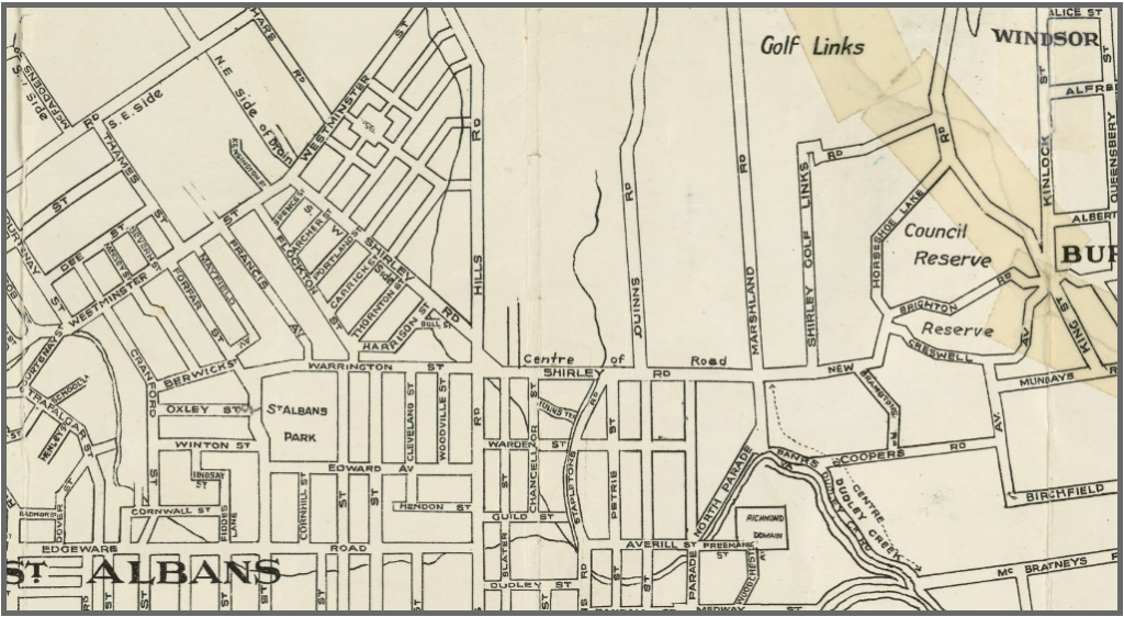
10 Shirley Road is central to connecting communities in Shirley, Dallington, Richmond, Edgeware, St Albans & Mairehau.

– Why the suburbs of Shirley, Dallington, Richmond, Edgeware, St Albans & Mairehau?
When you draw a 2km radius from 10 Shirley Road, these are the suburbs included in this area.
https://www.shirleyroadcentral.nz/shirley-road-central/


2. Constitution
Aim:
To support the development of a community hub including a modern library, and meeting rooms on the site at 10 Shirley Road for the use of the surrounding communities.
Objects:
The objects of the Group are:
3.1 To encourage the urgent development of public facilities and activities particularly for the residents of the area:
3.2 To encourage any activity that promotes the wellbeing of residents of the area:
3.3 To engage in any charitable activities for the benefit of the locality and residents of the area.
https://www.10shirleyroad.org.nz/wp-content/uploads/2024/05/Shirley-Road-Central-Constitution-2021.pdf


3. Committee Members
Joanna Gould, Don Gould, Jennifer Dalziel, Joanne Byrne, Margaret Stewart, Mark Wilson, Stephen McPaike, Jacqueline Tither, Paul Smith, Tuangane Matangi, Jason Harvey, Alan Liefting, Melinda Biggs, Jennifer McKinnel & Paul McKinnel


4. Current Status
Registered: 11 May 2021 to 28 Oct 2022.
Dissolved: 28 Nov 2022.

The ‘Shirley Road Central’ (SRC) residents group was setup just before the Christchurch City Council’s Long Term Plan in 2021.

In order to be seen as an official ‘Community Organization’ & not just a ‘Facebook group’ by Council staff, to enable our group to have extra time to speak at the CCC LTP verbal submission hearings.

The group’s constitution shows the aim was to advocate for a new community hub (modern library & meeting rooms) but divisions occurred over:
– ‘new’ community hub vs replacement ‘traditional’ community centre &
– ‘advocating’ for a new building vs ‘activating’ the 10 Shirley Road site.

Currently the SRC Website* is still live, but no longer updated.
SRC Facebook* Page & Community Group are still active & updated.
* I setup a separate SRC website & Facebook to distinguish between the SRC group view & my personal ideas/research as ‘Shirley Centre 10 Shirley Road’.


5. Website
https://www.shirleyroadcentral.nz/


6. Facebook Page
https://www.facebook.com/shirleyroadcentral/


7. Facebook Community Group
https://www.facebook.com/groups/shirleyroadcentral/


8. “Where is our Community Centre” Petition
– LTP 2021-2031 Petition from Shirley Road Central
“This petition was submitted to Council at the Long Term Plan (2021 to 2031) meeting in 2021 from the Shirley Road Central group.
The petition contains signatures in support of a new community facility on the Shirley Community Reserve.
The petition also resulted in Council asking staff to develop an updated feasibility study, looking at what options are appropriate for the reserve.”
https://letstalk.ccc.govt.nz/download_file/133/495

– “Where is our Community Centre” Petition
‘Shirley Road Central’ group members collected signatures/comments through an online ‘Change’ petition & in person via door knocking, outside local schools & onsite at ‘activation’ events like ‘Skip Day’, held at 10 Shirley Road.
https://www.10shirleyroad.org.nz/where-is-our-community-centre-petition/


9. Submissions to the Christchurch City Council
– 12.05.21, Item 3: Jennifer Dalziel & Joanne Burn – Shirley Road Central
https://www.youtube.com/watch?v=qhAT6iATaE8

– 11.05.22, Item 3: Shirley Rd Central, Jennifer Dalziel
https://www.youtube.com/watch?v=cKou63gGnws


10. Events
In my opinion, the ‘Pop up’ activities to ‘activate’ the 10 Shirley Road site had little success in creating connections: to the 10 Shirley Road site & between local residents.
Events like ‘Skip Day’ & the ‘Car Boot Sale’ organised by the ‘Shirley Road Central’ group:
– required many people to be involved in the planning & running of these events.
– more hours were invested in planning/meetings, than the actual duration of the event.
– Events had to be postponed or cancelled due to the weather.


11. Letters of Support from Local Christchurch MPs
– “The Richmond, Avonside, Dallington and Shirley Locals have a brilliant concept in their application to provide a Library and Education space and this new Community Centre could also provide a range of opportunities for the locals…
A space for after school activities and holiday programmes and possibly a venue for hire.
The Community Centre could also house NGO’s as well as drop in sessions for local organisations who could provide advice and assistance to those in need including Wellbeing/Health and Youth Clinics.
A Community Centre is a place where you are bringing everyone in the community together of all ethnicities and therefore I fully support this application.”
Hon Poto Williams, Member of Parliament for Christchurch East
https://www.10shirleyroad.org.nz/poto-williams-support-letter/

– “I write in support of further exploration of the community centre concept proposed for 10 Shirley Road.
While this is not in my electorate the area serviced by such a centre would cross into Christchurch Central and benefit my constituents.
I have read the support letter provided by MP for Christchurch East, Hon Poto Williams, and I am happy to add my support to her views and encourage council to consider exploring the idea further, such as commissioning a feasibility study for full review including the future of the current Shirley Library.”
Dr Duncan Webb, Member of Parliament for Christchurch Central
https://www.10shirleyroad.org.nz/duncan-webb-support-letter/


12. “The Future for Shirley Road Central” News Article (May 2021)
https://www.aveburyhouse.co.nz/uploads/4/7/2/0/47203855/rcn_152w.pdf
Richmond Community News, Page 5
“Following the Christchurch earthquakes the community centre at 10 Shirley Road was demolished.
It was a popular and welcoming community asset situated on multiple bus routes, reaching out to the communities of Shirley, Dallington, Richmond, Edgeware, St Albans and Mairehau.
A wide variety of people and groups attended this facility offering classes, courses and community events…
The library at the Palms is outdated and too small, it lacks meeting spaces and is not central to all local schools and bus routes.
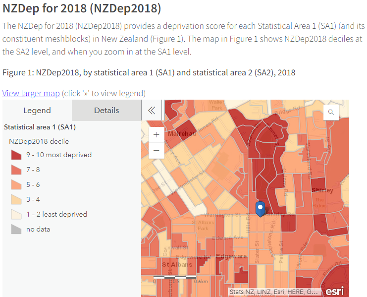
Our communities are ethnically and socially diverse.
We have areas of social deprivation, and others of relative well being.
We have increased social housing, and increased high density, infill housing.
As our population grows, the demand for community facilities grows also.
Church facilities can be a barrier for some of our secular community members.
School facilities are often limited in the times they are available…
In 2021 the land remains empty.
Our communities have waited over a decade for a replacement facility, while watching tens of millions of dollars spent on new community facilities in other areas of the city.
The decision to not rebuild ours has disadvantaged our community and continues to do so.
Our vision is a new community hub at Shirley Road Central.
We want a modern future-focused library, with learning/meeting spaces for all ages and stages of life.
We want a centre that is inclusive and accessible for all.”


13. ‘Study to determine feasibility of Christchurch community centre’ News Article (16 July 2021)
https://www.odt.co.nz/star-news/star-christchurch/study-determine-feasibility-christchurch-community-centre
An upcoming feasibility study could set the ball rolling on a $3 million community facility in east Christchurch.
Christchurch City Council’s Long Term Plan, approved last month, allocates $3 million towards a centre rebuild in the 2031-2032 financial year.
It also budgets $35,000 for a feasibility study to take place in the 2021-2022 financial year.
Innes Ward city councillor Pauline Cotter said the future of the project is in the hands of the community.
“It’s now with the community, they’re going to have to drive that,” Cotter said.
It is possible the $3 million funding could be brought forward if a building plan was ready and viable, she said.
Joanne Byrne, spokeswoman for the 10 Shirley Road [Shirley Road Central] group, helped organise a petition of over 1200 signatures which was presented to the council in May.
The community was devastated when funding was dropped from the last Long Term Plan and wanted to avoid a repeat of that scenario, she said.
Shirley Recreational Walkers leader Sue Lang said she hoped a new community centre would be built.
The site was currently home to a pump track and playground.
“That’s great, but it won’t meet the needs of the whole community,” Lang said.
However, she did not trust the council to pull through on the project.
“A decade is a long time to wait for when you’ve already waited a decade.”


14. ‘Lengthy delay in centre rebuild an ‘injustice’ News Article (4 August 2022)
https://www.yumpu.com/en/document/read/67122699/pegasus-post-august-04-2022
An 11-year delay in rebuilding a community facility has been described as an “injustice” to a “forgotten suburb”.
Community group Shirley Road Central chair Jennifer Dalziel has been advocating for a rebuild since the old facility was demolished, and described the whole process as “hugely frustrating”.
“My position is the injustice of it,” she said.
“They call Shirley the forgotten suburb…it’s like Shirley is just left out of everything.”
In May last year, Dalziel, along with Shirley residents passionate about the rebuild of the community centre, created a petition advocating for it.
They gained more than 1200 signatures from the community.
Innes Ward councillor Pauline Cotter said she can understand why Dalziel has described the process as an “injustice”.
“I can empathise with the community for having a community centre that was then gone,” she said.
“I feel like this area is kind of almost last to have areas restored…Shirley, in particular, needs the stability.”
Cotter said she fought alongside Papanui Ward councillor Mike Davidson to get the money for a feasibility study allocated to the city council’s Long Term Plan.
She said the wheels are starting to turn now, and hopes the feasibility study will be presented to the community board by the end of the year.
Dalziel said the whole process has been an “uphill battle against authorities” but has hope that the community facility will be restored.
“They’ve [city council] agreed to do something but what it’s going to be, we don’t know.”
(Front Page & Page 4)


15. ‘Shirley Community Centre’s future to be decided’ News Article (24 July 2023)
https://www.odt.co.nz/star-news/star-south-today/shirley-community-centres-future-be-decided
Shirley residents are one step closer to a decision on the suburb’s Community Reserve.
The Christchurch City Council is calling for submissions on the future of the contentious site.
Speaking during a deputation to city councillors, Mark Wilson said the Shirley Community Centre had been well used before the quakes.
“There are other areas of the city which have recently had new community centres built, more money and tens of millions of dollars thrown at them.
“And here we are. Shirley is still struggling to get a community centre rebuilt that they lost after the earthquakes.
“It’s inadequate, it’s embarrassing”.
Wilson said the Shirley community had lost a lot and needed its community centre.
“Build it, and they will come”.

Christchurch City Libraries by Community Board

Each pin is clickable and has more info/links, + & -, are in the bottom left hand corner, so you can zoom in/out.
Click on the square with arrow, in the top left hand corner, to show/hide map legend/layers.

Waitai Coastal-Burwood-Linwood Community Board
(5 suburban libraries)
https://ccc.govt.nz/culture-and-community/statistics-and-facts/community-profiles/coastal-burwood-linwood/
– Coastal: 3. Parklands Library & 5. New Brighton Library
– Burwood: 1. Shirley Library | The Palms Mall & 4. Aranui Library
– Linwood: 6. Linwood Library | Eastgate Mall

Waimāero Fendalton-Waimairi-Harewood Community Board
(2 suburban libraries)
https://ccc.govt.nz/culture-and-community/statistics-and-facts/community-profiles/fendalton-waimairi-harewood/
– Fendalton: 13. Fendalton Library
– Waimairi:
– Harewood: 14. Ōrauwhata Bishopdale Library and Community Centre

Waipuna Halswell-Hornby-Riccarton Community Board
(3 suburban libraries)
https://ccc.govt.nz/culture-and-community/statistics-and-facts/community-profiles/hornby-halswell-riccarton/
– Halswell: 10. Te Hāpua Halswell Centre
– Hornby: 11. Matatiki Hornby Centre
– Riccarton: 12. Upper Riccarton Library

Waipapa Papanui-Innes-Central Community Board
(2 suburban libraries & Tūranga)
https://ccc.govt.nz/culture-and-community/statistics-and-facts/community-profiles/papanui-innes-central/
– Papanui: 2. Papanui Library & 15. Redwood Library
– Innes*:
– Central*: 16. Tūranga (Metropolitan)
* No suburban library in either Innes or Central Ward.
From Papanui Road (Papanui Library/Papanui Ward) to Marshland Road (Shirley Library/Burwood Ward), children/residents/visitors are without access to a local suburban sized library in their area.

Waihoro Spreydon-Cashmere-Heathcote Community Board
(3 suburban libraries)
https://ccc.govt.nz/culture-and-community/statistics-and-facts/community-profiles/spreydon-cashmere-heathcote/
– Spreydon: 9. Spreydon Library
– Cashmere: 8. South Library
– Heathcote: 7. Matuku Takotako Sumner Centre

Te Pātaka o Rākaihautū Banks Peninsula Community Board
(4 libraries)
https://ccc.govt.nz/culture-and-community/statistics-and-facts/community-profiles/banks-peninsula/
Diamond Harbour, Little River, Akaroa & Lyttelton*
Only Lyttelton is included in this map.

Location Location Location

In real estate ‘location’ is key. Properties can be bought & sold based on ‘location’.

In urban planning & placemaking ‘location’ is also key.
“Placemaking inspires people to collectively reimagine and reinvent public spaces as the heart of every community. Strengthening the connection between people and the places they share, placemaking refers to a collaborative process by which we can shape our public realm in order to maximize shared value. More than just promoting better urban design, placemaking facilitates creative patterns of use, paying particular attention to the physical, cultural, and social identities that define a place and support its ongoing evolution.”
https://www.pps.org/category/placemaking
https://www.10shirleyroad.org.nz/placemaking/

The Shirley Community Reserve, located at 10 Shirley Road, is a ‘high profile, prime location, well situated with convenient access to local schools & transport routes’ in real estate terms.
https://www.10shirleyroad.org.nz/local-education-providers/
https://www.10shirleyroad.org.nz/shirley-centre-transport/

Originally Shirley Road started at Westminster Street (now Aylesford Street), before crossing over Hills Road to Marshland Road.

Original Shirley Road, Christchurch City Libraries Map 1903?
https://christchurchcitylibraries.com/Heritage/Maps/174743.asp

This location has been part of our communities ‘local identity’ & ‘a place of learning’ since the original Shirley Primary School building was built on this site in 1915.
https://www.10shirleyroad.org.nz/site-history/
https://www.10shirleyroad.org.nz/original-building/
https://www.10shirleyroad.org.nz/historic-landmark/


In our newly adopted Christchurch City Council ‘Equity & Inclusion Policy’, children/parents/residents/ratepayers aren’t suppose to be discriminated against or penalised by where they can afford to live.
“Equality means each individual or group of people is given the same resources or opportunities.
Equity recognises that each person has different circumstances and allocates the exact resources and opportunities needed to reach an equal outcome.”
People should have equity, regardless of age*, gender, disability*, ethnicity, culture, faiths, geographical location*, sexual orientation, neurodiversity* or socio-economic status.*
https://www.10shirleyroad.org.nz/ccc-equity-and-inclusion-policy/
* age: see ‘Shirley Centre | Education Proivders’
* disability & neurodiversity: see ‘Shirley Centre | Support Providers’
* geographical location: see ‘Shirley Cenre | Libraries’
https://www.10shirleyroad.org.nz/shirley-centre-map/
* geographical location & socio-economic status:
See images below: CCC District Plan Zones & StatsNZ Deprivation Score for the areas around the Shirley Community Reserve.
Also see: https://www.10shirleyroad.org.nz/shirley-centre-transport/

Christchurch City Council District Plan: Zones
H5: Shirley Community Reserve, 10 Shirley Road, Richmond
Residential Suburban Density Transition (West) & Residential Medium Density Zone (East)
Christchurch City Council District Plan: Notations
H5: Shirley Community Reserve, 10 Shirley Road, Richmond
Community Housing Redevelopment (North) & Dudley Character Area (South)
StatsNZ Deprivation Score (2018)
Blue Marker: Shirley Community Reserve, 10 Shirley Road, Richmond

Yet we have no suburban library in either the Innes or Central Ward?
Shirley Road is on the border of the Innes & Central Ward, since the Ward boundary & Community Board changes in 2022.
https://ccc.govt.nz/the-council/how-the-council-works/governance/representation-review/
https://ccc.govt.nz/assets/Documents/The-Council/How-the-Council-works/2022-election/Maps/Christchurch-City-Council-Representation-Review-2021-Final-determination-amended-June-2022.pdf Page 21 & 23 StatsNZ Population


Christchurch City Libraries by Community Board/Ward
See ‘Shirley Centre | Libraries’: https://www.10shirleyroad.org.nz/shirley-centre-map/
1. Waitai Coastal-Burwood-Linwood Community Board
(5 suburban libraries)
https://ccc.govt.nz/culture-and-community/statistics-and-facts/community-profiles/coastal-burwood-linwood/
– Coastal: 3. Parklands Library & 5. New Brighton Library
– Burwood: 1. Shirley Library | The Palms Mall & 4. Aranui Library
– Linwood: 6. Linwood Library | Eastgate Mall
2. Waimāero Fendalton-Waimairi-Harewood Community Board
(2 suburban libraries)
https://ccc.govt.nz/culture-and-community/statistics-and-facts/community-profiles/fendalton-waimairi-harewood/
– Fendalton: 13. Fendalton Library
– Waimairi:
– Harewood: 14. Ōrauwhata Bishopdale Library and Community Centre
3. Waipuna Halswell-Hornby-Riccarton Community Board
(3 suburban libraries)
https://ccc.govt.nz/culture-and-community/statistics-and-facts/community-profiles/hornby-halswell-riccarton/
– Halswell: 10. Te Hāpua Halswell Centre
– Hornby: 11. Matatiki Hornby Centre
– Riccarton: 12. Upper Riccarton Library
4. Waipapa Papanui-Innes-Central Community Board
(2 suburban libraries & Tūranga)
https://ccc.govt.nz/culture-and-community/statistics-and-facts/community-profiles/papanui-innes-central/
– Papanui: 2. Papanui Library & 15. Redwood Library
– Innes:
– Central: 16. Tūranga (Metropolitan)
5. Waihoro Spreydon-Cashmere-Heathcote Community Board
(3 suburban libraries)
https://ccc.govt.nz/culture-and-community/statistics-and-facts/community-profiles/spreydon-cashmere-heathcote/
– Spreydon: 9. Spreydon Library
– Cashmere: 8. South Library
Heathcote: 7. Matuku Takotako Sumner Centre
6. Te Pātaka o Rākaihautū Banks Peninsula Community Board
(4 libraries)
https://ccc.govt.nz/culture-and-community/statistics-and-facts/community-profiles/banks-peninsula/
Diamond Harbour, Little River, Akaroa & Lyttelton


From Papanui Road (Papanui Library/Papanui Ward) to Marshland Road (Shirley Library/Burwood Ward), children/residents/visitors are without access to a local suburban sized library.

The current (2nd) Shirley Library* is located on the edge of the Burwood Ward & has a limited book selection, no board room, meeting rooms or learning centre (flexible spaces) & didn’t rate well in the Youth Audit.
https://www.10shirleyroad.org.nz/youth-audit-shirley-library/

* There are no toilets available in the Library area.
Toilets for the building are located in the corridor off the Main Entrance to the building.
https://www.flickr.com/photos/christchurchcitylibraries/3978229955/in/album-72157611803290908/
Why is this an issue?:
– you have to leave unissued books in the library, due to security gates as you leave the Library area or take issued books into the Toilets.
– you can’t see the Toilets from the Library area:
a. Young children left unsupervised, could leave via the Main Entrance doors by the carpark.
b. If you have more than one child you can’t see them in the library, while attending to another child wanting to go to the toilet.
c. These toilets don’t align with the new ‘CCC Equity and Inclusion Policy’
https://www.10shirleyroad.org.nz/ccc-equity-and-inclusion-policy/


“Shirley Library [1st] opened in July 1981 on a site now covered by The Palms.
Its’ approximate location was where the fruit and vegetable section of Woolworth’s supermarket now stands.”
“In January 29 1996 the new library [2nd] opened in a purpose-built building shared with the Christchurch City Council Shirley Service Centre.
The building included a boardroom* for the community board.”

* In the Shirley Libary (2nd) original plan: 1995, the Boardroom (which no longer exists) was located North off the Main Entrance.
The Shirley Service Centre was located right off the Main Entrance.

Today the Shirley Service Centre & NZ Post are located left off the Main Entrance, in the Library area.
The Waitai Coastal-Burwood-Linwood Community Board Governance Team are located right off the Main Entrance, in the former Shirley Service Centre area.

Shirley Library (2nd) Original Plan: 1995

“The new library, which more than doubles the previous library, features an activities room for class visits, story times, senior citizens guest speaker programmes and other activities.
The building, designed by Ian Krause Architects Ltd and built by Fletcher Construction, was provided by the developers* of the new Shirley Shopping Centre – to be know as The Palms – to allow for expansion of the shopping centre and carpark over the previous library and service centre land.
The Christchurch City Council provided the fit out costs for the building.”
https://heritage.christchurchcitylibraries.com/Archives/52/Library150/Articles/ShirleyLibrary/
* See ‘The Palms Mall’ https://www.10shirleyroad.org.nz/shirley-centre-funding/

Christchurch City Council & Waipapa Papanui-Innes-Central Community Board, why are we still waiting?
https://www.10shirleyroad.org.nz/why-are-we-still-waiting/
– Why isn’t there already a suburban sized local library in the Innes/Central Ward?
– Why after reading all this info/research, are we not bringing funding forward to plan/build a new suburban sized local library at the Shirley Community Reserve, 10 Shirley Road, where the Innes/Central Ward boundaries connect?


Other relevant Blog Posts:
https://www.10shirleyroad.org.nz/ccc-integrated-planning-guide/
https://www.10shirleyroad.org.nz/ccc-citizen-hub-strategy/
https://www.10shirleyroad.org.nz/shirley-centre-questions/
https://www.10shirleyroad.org.nz/shirley-centre-positives/
‘New Shirley Centre | Ideas & Research’:
https://www.10shirleyroad.org.nz/shirley-centre-overview/

Shirley Centre Transport

Modes of transport to 10 Shirley Road & new resources available at Shirley Community Reserve:
1. Shirley Community Reserve Location
2. Driving: Off Street & Street Parking
3. Public Transport: Buses
4. Bikes & Scooters
5. Walking
Includes:
– 1.1 Water Fountain, 1.2 Information Board & Interpretation Board(s)
– 5.1 Dudley Creek Walking Track & 5.1.2. MacFarlane Park Birdsong Trail
From the North in Shirley, through Shirley Primary School grounds, crossing over Shirley Road to the Shirley Community Reserve, South through Richmond, to connect up with the Ōtākaro Avon River Corridor.
– 5.1.3 StoryWalk®, 5.1.4 Dewey Decimal Trail & 5.1.5 Footpath Obstacle Course


1. Shirley Community Reserve Location
The Shirley Community Reserve is situated at 10 Shirley Road, Richmond, Christchurch.
Originally Shirley Road started at Westminster Street (now Aylesford Street), before crossing over Hills Road to Marshland Road.
https://christchurchcitylibraries.com/Heritage/Maps/174743.asp
10 Shirley Road is located between two main intersections/arterial roads:
– Shirley Road / Marshland Road / New Brighton Road / North Parade &
– Shirley Road / Hills Road / Warrington Street intersection
https://letstalk.ccc.govt.nz/safer-shirley
“The youth auditors really liked how the space is well connected within Shirley. 10 Shirley Road is right in the middle of other spaces local young people would access and is surrounded by bus stops connected to the central network. They enjoy using the space as it is easily accessible and its activities give them something to do, while making them feel like they belong. The areas young people thought could be improved on were the lack of basic amenities in the space and the underutilisation of the space. The space would benefit from having a toilet, water fountain*, and lighting as these facilities would make it more practical and safe for youth.”
– 1.1. Water Fountain
* There are no water fountains available along Shirley Road.
https://smartview.ccc.govt.nz/data/drinking-fountains
– 1.2. Information Board
“Another idea the auditors raised was to add an information board which includes youth-focused information and advertising.
It should also include contacts to youth services and providers, in both Shirley and neighbouring areas. This will help young people feel comfortable with accessing support and could possibly introduce them to new groups and clubs.”
https://www.10shirleyroad.org.nz/youth-audit-10-shirley-road/
New Signage: Interpretation Board(s)
“These would tell the stories of both local and city-wide significance; original school heritage buildings, community centre and its role in the community, historic domestic buildings adjacent to the park, and Dudley Creek remediation.”
https://www.10shirleyroad.org.nz/shirley-community-reserve-memo/

Shirley Community Centre Rebuild
“The site at 10 Shirley Road is 9042 square metres more or less and is owned by the Council and is held in trust for local purpose (site for a community centre).
The site is bordered by Shirley Road, Chancellor Street, Slater Street and Dudley Creek.
The local [Shirley] Playcentre holds a separate lease (approximately 769m2).
[See Shirley Centre Map, Shirley Centre | Education Providers, 14. Shirley Playcentre]
10 Shirley Road has the advantage of a generous ground area and is designated specifically for the purpose of community facilities.”
https://christchurch.infocouncil.biz/Open/2016/08/SPCB_20160831_AGN_689_AT.PDF, Page 52


2. Driving: Off Street Parking
See Shirley Centre Map, Shirley Centre | Transport
New carpark behind the new Centre building (Shirley Community Reserve, South End), using existing Main Entrance off Slater Street.
– 2.a Disabled Parking
– 2.b. EV Charging Stations (available at suburban Christchurch City Council libraries through Orion).

2. Driving: Street Parking
– 2.1. Shirley Road
– 2.2. Slater Street
– 2.3. Chancellor Street (North)
– 2.4. Julius Terrace
– 2.4.a Footbridge from Julius Terrace to Stapletons Road
– 2.5. Chancellor Street (South)
– 2.5.a Footbridge from Chancellor Street (South) to Chancellor Street (North)
– 2.6. Warden Street
– 2.7. Stapletons Road


3. Public Transport: Buses
Metro Bus Routes Network Map
Metro Bus Timetables
Christchurch City Council SmartView Bus Network Map

See Shirley Centre Map, Shirley Centre | Transport
3.1. Metro Bus Stop 39710
Shirley Rd near Slater St (South side of Shirley Road) for 100, 7 & Orbiter
3.2. Metro Bus Stop 39625
Shirley Rd near Slater St (North side of Shirley Road) for 100, 7 & Orbiter
3.3. Metro Bus Stop 24345
Emmett St near Shirley Rd (heading North on Emmett St) for 44
3.4. Metro Bus Stop 38420
Shirley Rd near Stapletons Rd (heading East on Shirley Road) for 44

This location at 10 Shirley Road is accessible by public transport for residents in:
Shirley, Dallington, Richmond, Edgeware, St Albans & Mairehau
Plus: Citywide (Orbiter), Merivale, Parklands, Burwood & Avonside.

Metro Bus Timetables for 7, 44, 100 & Orbiter
Metro Bus Route 7 Halswell to Queenspark Timetable
Parklands, Burwood, Dallington, Edgeware & Richmond residents
Metro Bus Route 44 Shirley to Westmorland Timetable
Dallington, Shirley, Mairehau & Edgeware residents
Metro Bus Route 100 Halswell & Wigram to The Palms Timetable
Shirley, Edgeware, St Albans & Merivale residents
Metro Bus Route Orbiter Timetable
citywide loop which includes Mairehau, Shirley, Richmond & Avonside residents


4. Bikes & Scooters
Christchurch City Council SmartView Cycle Routes Network Map
Christchurch City Council SmartView Scooters & eBikes (Hire) Location Map
Christchurch City Council City to Sea Pathway
New Road Crossings for the City to Sea Pathway

See Shirley Centre Map, Shirley Centre | Transport
New Bike & Scooter Racks located near Shirley Road, by the Half Basketball Court.
New Bike Repair Station located near Shirley Road, by the Half Basketball Court.
Easy to access for those travelling through the suburbs & the Ōtākaro Avon River Corridor.
– 4.1. Bike & Scooter Racks
https://www.securabike.co.nz/Shop/Bike-Racks
https://www.securabike.co.nz/Shop/Scooters-and-Skateboards
– 4.1.a Locky Docks
“Using your Metrocard with Locky Docks: Locky Docks are free, secure locking stations for bikes, e-bikes and scooters, and can be accessed with your Metrocard. There are Locky Docks around the CBD with CCTV cameras and built-in alarms.
Locky Docks locations:
https://ccc.govt.nz/transport/getting-around/cycling/cycling-maps/
Click on ‘Layers’ & select ‘Cycle stands’. Locky Docks are the pink pins on the map.
How to use Locky Docks:
Tap your Metrocard to lock and unlock. Any bike, e-bike or scooter will fit. There is no fee to use a Locky Dock so nothing will be charged to your Metrocard.”
https://www.lockydock.co.nz/
– 4.2. Bike Repair Station
https://www.securabike.co.nz/Shop/Bicycle-Repair-Station/Bicycle-Repair-Station-Type-1
https://www.securabike.co.nz/Shop/Bicycle-Repair-Station/Bicycle-Repair-Station-Type-3
https://rtl.co.nz/product/cidws26347s/saris-deluxe-bike-repair-stand
https://rtl.co.nz/product/cihsp26246/outdoor-public-bike-pump-with-gauge
https://rtl.co.nz/resource/rtl-brochure-bike-repair-stands-gallery


5. Walking
see Shirley Centre Map, Shirley Centre | Transport
Includes:
– 1.1 Water Fountain, 1.2 Information Board & Interpretation Board(s)
– 5.1 Dudley Creek Walking Track & 5.1.2. MacFarlane Park Birdsong Trail
From the North in Shirley, through Shirley Primary School grounds, crossing over Shirley Road to the Shirley Community Reserve, South through Richmond, to connect up with the Ōtākaro Avon River Corridor.
– 5.1.3 StoryWalk®, 5.1.4 Dewey Decimal Trail & 5.1.5 Footpath Obstacle Course

– 5.1 Dudley Creek Walking Track
See ‘Dudley Creek Flood Remediation’ https://www.10shirleyroad.org.nz/historic-landmark/ & https://riseuprichmond.nz/dudley-creek/
Bring residents out into their local communities to appreciate the existing tree canopy while walking along Dudley Creek & finding information about local birds/sites/Dudley Creek Flood Remediation.
The landscaping work that was done, as part of the ‘Dudley Creek Flood Remediation’, has created a picturesque ‘inviting and accessible waterway corridor’.
This track starts in the Shirley Shopping Centre, located at the corner of Hills & Shirley Road & ends at the Petrie Street ‘Dudley Creek Flood Remediation’ intake structure.
5.1.a. Shirley Shopping Centre Carpark (corner of Hills & Shirley Road)
5.1.b. Dudley Creek Esplande (9. ‘Shirley Centre | Parks’): 159 Slater Street, Richmond (path from Slater Street to Shirley Shopping Centre)
5.1.c. Shirley Community Reserve path (South End of the Reserve)
5.1.d. Julius Terrace path (across 2.4.a Footbridge ‘Shirley Centre | Transport’)
5.1.e. Along Stapletons Road
5.1.f. Past Petrie Park (8. Petrie Park ‘Shirley Centre | Parks’)
5.1.g. Along to 72 Stapletons Road (path on the left hand side, next to the bridge)
5.1.h. Along path to 65 Petrie Street, Richmond (path from Stapletons Road to Petrie Street)

– 5.1.1. The Green Lab Richmond Community Wayfinding
“Richmond Community Wayfinding is the first phase of a wayfinding route through Richmond and the Ōtākaro Avon River Corridor. The project began in conversation in late 2019, and was designed and built with community members in 2020.”
https://thegreenlab.org.nz/richmond_community_wayfinding/

Richmond Wayfinding & Parklet Project Ideas by Joanna Gould, July 2020
“Build Bird Houses & Feeders. Low cost project, great way to involve children & families. (* Trail based on https://riseuprichmond.nz/dudley-creek/)
This area is already home to many different birds, adding a bird house brings the birds down closer to the people using the trail & adding a bird feeder is an interactive way people can help increase the bird population.
Add info about each NZ bird species to a different bird house/feeder, link to the Department of Conservation website:
https://www.doc.govt.nz/nature/native-animals/birds/birds-a-z/ (info about each bird/sound recordings/habitat etc).”

– 5.1.2. MacFarlane Park Birdsong Trail
“MacFarlane Park is at the heart of a densely populated state housing area.
Thanks to the Shirley Community Trust…As part of a series of initiatives to increase pride in the park, the Birdsong Trails aim to create liveable spaces for the winged members of the Shirley community.
Several urban corridors run through Macfarlane Park connecting schools, housing and two community centres. Children and parents walk along these pathways on the way to school and to the community gardens every day. To make the walk more attractive, The Trust had the vision of planting the corridors with native trees and shrubs. This would thereby attract the birds and create opportunities for future education initiatives.
The long term goals of the Birdsong Trails include working with the schools to build bird houses and bird feeder stands, provide education about bird life and improve the ecosystems for native wildlife.”
https://shop.topflite.co.nz/blogs/news/good-egg-the-shirley-community-trust

– 5.1.3 StoryWalk®
“StoryWalk® programs – promoting literacy, reading, health, exercise, and movement in communities and neighborhoods across the United States and the world…Typically, pages from a children’s book are installed along a path. As you stroll along the path, you’re directed to the next page in the story. Pages frequently are accompanied by activities or information.”
https://letsmovelibraries.org/storywalk/

– 5.1.4 Dewey Decimal Trail
“The Dewey Decimal Trail, nestled within the library’s beautifully landscaped surroundings, features 10 distinct pictorial guideposts, each corresponding to the 10 subject areas of the renowned Dewey Decimal System. This unique feature allows visitors to not only enjoy a leisurely stroll, but also to gain insight into the various disciplines that contribute to the vast world of knowledge encompassed by the library’s collection…The Dewey Decimal Trail is not only a wonderful destination for individuals and families seeking a peaceful outdoor experience, but also an ideal spot for school group visits.”
https://texasborderbusiness.com/new-enhancements-to-dewey-decimal-trail-at-mcallen-public-library/

– 5.1.5 Footpath Obstacle Course
Painted gross motor skills movements/exercises on footpaths going through the Shirley Community Reserve.
https://www.facebook.com/kendallyounglibrary/videos/258362138811833/
“Edge Line Marking [North Canterbury] specialise in creating diverse and interactive markings to encourage outdoor play.”
https://www.edgelinemarking.co.nz/school-grounds

– 5.2 Shirley Road Pedestrian Signalised Crossing
This is located outside the Shirley Primary School & crosses over to the Shirley Community Reserve.

– 5.3 Pedestrian Entrances to the Shirley Community Reserve, 10 Shirley Road
5.3.a. Shirley Road Entrance (connects to 5.2 Shirley Road Pedestrian Signalised Crossing)
5.3.b. Chancellor Street Entrance (North, by the Half Basketball Court)
5.3.c. Chancellor Street Entrance (South, behind the Shirley Playcentre)
5.3.d. Slater Street Entrance (South, Main Entrance to the new carpark, behind the new Centre building)
5.3.e. Slater Street Entrance (North)

Shirley Centre Map

Each pin is clickable and has more info/links, + & -, are in the bottom left hand corner, so you can zoom in/out.
Click on the square with arrow, in the top left hand corner, to show/hide map legend/layers.

Shirley Centre | Shirley Community Reserve, 10 Shirley Road, Richmond
Proposed site of new Shirley Centre.
https://www.10shirleyroad.org.nz/building-ideas/
https://www.10shirleyroad.org.nz/landscape-ideas/
https://www.10shirleyroad.org.nz/playground-ideas/
Community Hub: Library, Service Centre, Learning Spaces, Meeting Rooms, Playground & Recreational Space.
https://www.10shirleyroad.org.nz/shirley-centre-overview/
Connecting Communities around Shirley Road, Christchurch
Suburbs: Shirley, Dallington, Richmond, Edgeware, St Albans & Mairehau.
https://www.10shirleyroad.org.nz/
https://www.facebook.com/ShirleyCentre10ShirleyRoad/


Shirley Centre | Libraries
There are 17 Christchurch City Council Libraries located in the Christchurch area.
https://christchurch.bibliocommons.com/v2/locations

The current Shirley Library is located in the carpark of The Palms (Burwood Ward).
Shirley Library is considered a ‘suburban’ library.
From Papanui Road (Papanui Library/Papanui Ward) to Marshland Road (Shirley Library/Burwood Ward), children/residents/visitors are without access to a local suburban sized library.
https://ccc.govt.nz/culture-and-community/statistics-and-facts/community-profiles/papanui-innes-central/ (Ward Boundary Map, Quick Stats & Facilities)

The current Shirley Library* has a limited book selection, no boardroom, meeting rooms or learning centre (flexible spaces) & didn’t rate well in the Youth Audit.
https://www.10shirleyroad.org.nz/youth-audit-shirley-library/

* There are no toilets available in the Library area.
Toilets for the building are located in the corridor off the Main Entrance to the building.
https://www.flickr.com/photos/christchurchcitylibraries/3978229955/in/album-72157611803290908/
Why is this an issue?:
– you have to leave unissued books in the library, due to security gates as you leave the Library area or take issued books into the Toilets.
– you can’t see the Toilets from the Library area:
a. Young children left unsupervised, could leave via the Main Entrance doors by the carpark.
b. If you have more than one child you can’t see them in the library, while attending to another child wanting to go to the toilet.
c. These toilets don’t align with the new ‘CCC Equity and Inclusion Policy’
https://www.10shirleyroad.org.nz/ccc-equity-and-inclusion-policy/


Shirley Centre | Education Providers
There are 14 schools, kindergartens & playcentres located within a 2km radius of the 10 Shirley Road, Shirley Community Reserve.
This map does not include all early childhood education centres.


Shirley Centre | Support Providers
There are 11 support providers located within a 3km radius of the 10 Shirley Road, Shirley Community Reserve.

These Support Providers available in our area, help locals & those travelling to these area from around Christchurch:
– Child Development: Shirley Toy Library & North Parade Plunket (Shirley)
Specialist Teaching: Seabrook McKenzie Centre, Ferndale Te Ahu School & The Champion Centre
– Neurodiverse: Autism NZ (Canterbury & West Coast)
– Adult Education: Hagley Adult Literacy Centre (Literacy & Numeracy, First Steps, Computer Skills, ESOL)
– Intellectual Disabilities: Helen Anderson Trust & Delta Community Support Trust (Friendship Link)
– Pain Management: Burwood Hospital Pain Management Centre
– Brain Injury: Laura Fergusson Trust
– Older Persons: Delta Community Support Trust (Evergreen Club)


Shirley Centre | Community Centres
There are 8 community centres located within a 2km radius of the 10 Shirley Road, Shirley Community Reserve.
– 1. MacFarlane Park Centre (MPC)
Shirley Community Trust/St Stephen’s Anglican Church
19A Acheson Ave, Shirley (down service lane)
https://shirleycommunitytrust.org.nz/
– 2. MacFarlane Park Neighbourhood Centre (MPNC)
Shirley Community Trust/St Stephen’s Anglican Church
19 Acheson Ave, Shirley
https://shirleycommunitytrust.org.nz/
– 3. Rhombus
21 Acheson Avenue, Shirley
https://rhombus.nz/
– 4. Avebury House
Avebury House Trust
9 Eveleyn Couzins Avenue, Richmond
https://www.aveburyhouse.co.nz/
– 5. North Avon Community Centre
Delta Community Support Trust/North Avon Baptist Church/Crossway Community Church
101 North Avon Road, Richmond
http://www.deltatrust.org.nz/
– 6. St Albans Community Centre
St Albans Residents Association (SARA)
1049 Colombo Street, St Albans
https://www.sacc.org.nz/
– 7. The Whānau Centre
Neighbourhood Trust/St Albans Baptist Church
49 Nancy Avenue, Mairehau
https://nht.org.nz/the-whanau-centre/
– 8. Richmond Cottage
Christchurch City Council
Corner of (78) London and Pavitt Streets, Richmond
https://ccc.govt.nz/culture-and-community/community-facilities/venues-for-hire/richmond-cottage
“Richmond Caretakers Cottage. In 1873 the Bingsland School was built on land that is now known as the ‘Village Green’. Behind the school headmasters house – built in 1876, was the caretakers cottage, located on the corner of London and Cumberland (now Pavitt) Street. The headmasters house was demolished in 1912, but the caretakers’ house still remains today. After the school was moved to a different site, the old grounds became public recreation ground with the swimming baths still on this site on the southwest corner. In 1978 renovations to save the historic cottage began and in 1982 it was officially opened as the Richmond Neighbourhood Cottage.”
https://www.aveburyhouse.co.nz/uploads/4/7/2/0/47203855/rcn-024-april_2005.pdf


Shirley Centre | Community Gardens
There are 7 community gardens located within a 2km radius of the 10 Shirley Road, Shirley Community Reserve.


Shirley Centre | Recreational Facilities
There are 32 recreational facilities located within a 2km radius of the 10 Shirley Road, Shirley Community Reserve.

* 32. Shirley Pump Track (currently located on the grass area/site of the former community centre building at 10 Shirley Road) could be relocated to 5. Avon Hub (co-locating outdoor sports activities with 26. North Parade Fitness Equipment)


Shirley Centre | Playgrounds
There are 17 playgrounds located within a 2km radius of the 10 Shirley Road, Shirley Community Reserve.
This map does not include school, kindergarten or playcentre playgrounds.

* 1. Shirley Community Reserve Playground needs a renewal, see https://smartview.ccc.govt.nz/data/parks
– Swing, See-Saw & Senior Play Modular Unit: Commissioned 1998-12-31
– Platform, Ladders, Climbing Net, Slide, Tunnel & Firemans Pole: Commissioned 2010-12-29

This playground needs to be redeveloped so that it is inclusive & accessible.
see https://www.10shirleyroad.org.nz/ccc-equity-and-inclusion-policy/ &
https://www.10shirleyroad.org.nz/playground-ideas/

“7.3 Community Needs Analysis for Richmond
– Need for improved playground facilities across Richmond targeting pre-schoolers and small children.”
(Shirley Community Facility Feasibility Study, Page 22)
https://www.10shirleyroad.org.nz/shirley-community-facility-feasibility-study/
[see 14. Shirley Playcentre in ‘Education Providers’, located in the Shirley Community Reserve, next to the current playground.]


Shirley Centre | Parks
There are 18 parks located within a 2km radius of the 10 Shirley Road, Shirley Community Reserve, including the Ōtākaro Avon River Corridor.
https://www.10shirleyroad.org.nz/local-green-spaces/


Shirley Centre | Transport
Modes of transport to 10 Shirley Road & new resources available at Shirley Community Reserve:
1. Shirley Community Reserve Location
2. Driving: Off Street & Street Parking
3. Public Transport: Buses
4. Bikes & Scooters
5. Walking
Includes:
– 1.1 Water Fountain, 1.2 Information Board & Interpretation Board(s)
– 5.1 Dudley Creek Walking Track & 5.1.2. MacFarlane Park Birdsong Trail
From the North in Shirley, through Shirley Primary School grounds, crossing over Shirley Road to the Shirley Community Reserve, South through Richmond, to connect up with the Ōtākaro Avon River Corridor.
– 5.1.3 StoryWalk®, 5.1.4 Dewey Decimal Trail & 5.1.5 Footpath Obstacle Course
https://www.10shirleyroad.org.nz/shirley-centre-transport/