– Google Maps
– Street View
– Papanui-Innes Community Board
– Parking
– Metro Bus Routes
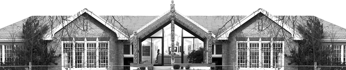
10 Shirley Road was the original site of the Shirley Primary School, then former Shirley Community Centre & part of the Shirley Community Reserve with the Shirley Playcentre.
“The site at 10 Shirley Road is 9042 square metres more or less and is owned by the Council and is held in trust for local purpose (site for a community centre).”
8. Shirley/Papanui Community Board Area Update, 2. Community Activities, 2.2 Shirley Community Centre Rebuild, Site Selection
https://christchurch.infocouncil.biz/Open/2016/08/SPCB_20160831_AGN_689_AT.htm
Google Maps
Street View
Papanui-Innes Community Board
– https://ccc.govt.nz/the-council/how-the-council-works/elected-members/community-boards/papanui-innes/
This site is in the Papanui-Innes Community Board, as part of the Innes ward:
“Annual growth since 2013 has been higher than anticipated and the estimated population has already exceeded the projected 2018 population.”
“2 Council libraries: Redwood, Papanui.” No Council Library in the Innes Ward.
– https://www.ccc.govt.nz/culture-and-community/statistics-and-facts/community-profiles/papanui-innes/
– https://ccc.govt.nz/culture-and-community/statistics-and-facts/community-profiles/papanui-innes/innes-ward
Parking
Onsite Parking: around the building as indicated below
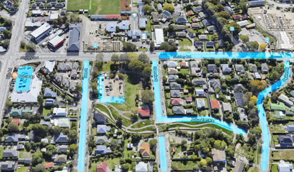
Off Street Parking:
– Cnr Hills Road & Shirley Road Shopping Centre, pathway from car park to Slater Street, following Dudley Creek
– Shirley Road
– Slater Street
– Chancellor Street, with bridge over Dudley Creek by the Shirley Playcentre
– Julius Terrace, with bridge to Stapletons Road
– Stapletons Road
The Dudley Creek Flood Remediation project has included new pathways and landscaping, between Slater Street and Stapletons Road.
Metro Bus Routes
Bus stops are located outside 10 Shirley Road, and across the road, by Shirley Primary School.
– http://www.metroinfo.co.nz/map/
7: Halswell/Queenspark
Halswell > Addington > Christchurch Hospital > Bus Interchange > The Palms > Burwood Hospital > Queenspark
“Accessing key destinations between Halswell and Queenspark, route 7 includes Addington at its western end and both The Palms and Burwood Hospital towards the east. As a core route, it runs around every 15 minutes until 7pm, and half hourly in the evenings.”
– https://www.metroinfo.co.nz/timetables/7-halswell-queenspark/
Or: The Orbiter
Eastgate Shopping Centre > St Martins > Princess Margaret Hospital > Barrington Mall > Westfield Riccarton > Burnside High School > Northlands Mall > The Palms > Eastgate Shopping Centre
“Jump aboard our most popular bus route for easy access to Christchurch’s malls and shops outside of the central city. The Orbiter is along every few minutes, running in both clockwise and anti-clockwise directions. You can even treat The Orbiter as the most affordable Christchurch tour on offer – have you done the whole loop?”
– https://www.metroinfo.co.nz/timetables/orbiter/
100: Wigram/The Palms via Riccarton
Halswell > Wigram > Church Corner > University of Canterbury > Westfield Riccarton > Merivale Mall > The Palms
“As an important suburban connector, route 100 runs frequently throughout the day. Popular with students and shoppers, it connects the University, Westfield Riccarton, Merivale Mall and The Palms with their surrounding suburbs.”
– https://www.metroinfo.co.nz/timetables/100-wigram-the-palms/